
Avalanche Detection: A Comprehensive Survey of SAR Imaging and
Machine Learning Approaches
Shubhangi Vairagar
1
, Priya Metri
1
, Chetana Shravage
1
, Akshay Kudalkar
2
, S. Rahul Srinivas
2
,
Ayush Kale
2
and Mukul Salvi
2
1
Department of AI and Data Science,Dr. D.Y. Patil Institute of Technology, Pune, India
2
Artificial Intelligence and Data Science, Dr. D.Y. Patil Institute of Technology,Pune, India
Keywords:
AvaWatch, Avalanlche Detection System, Synthetic Aperture Radar (SAR), Machine Learning, SAR Satellite
Imagery, Python, Computer Vision.
Abstract:
Avalanches create immense risks regarding life, infrastructure, and eco-systems in snowy lands. The require-
ments of the high accuracy and efficiency in avalanche detection and monitoring are highly raised. New
horizons appeared in avalanche detection, utilizing both ML techniques and SAR technologies, with advanced
imagery analysis. This paper represents a more detailed survey on avalanche-detection systems, applying
various ML methods, combined with SAR data. It categorizes, analyzes, and discusses key methodologies -
supervised, unsupervised, and deep learning models - including their strengths, limitations, and applications.
1 INTRODUCTION
Avalanches pose aggressive threats in snow-covered
alpine regions, threatening human lives, infrastruc-
ture, and the environment. Early detection and
warnings are necessary to prevent tragic incidents
and ensure safety of people in avalanche-prone lo-
cations. AvaWatch is an innovative Avalanche De-
tection System that addresses this issue by combin-
ing Synthetic Aperture Radar (SAR) satellite data
with advanced machine learning techniques to de-
tect probable avalanche dangers in real time. This is
an endeavor aimed at enhancing avalanche security
in India’s snow-covered mountains using high tech-
nologies to provide the people with real-time alerts
and enhancing catastrophic preparedness. Avalanche
detection systems are one of the significant areas
of research these days. As the importance to the
safety measures for those who stay in hilly places
keeps on growing, many technologies such as Syn-
thetic Aperture Radar (SAR), and machine learning
models are being used to detect avalanche activity
. ESA’s Copernicus Programme provides real-time
access to SAR data, which is important for continu-
ous monitoring of snow-covered areas susceptible to
avalanches.(European Space Agency, 2020)
One of the first-ever studies in this area was
the use of SAR as the dataset for snow cover and
avalanche monitoring. This was first-time exploita-
tion of SAR for snow parameter extraction was made
by Ulaby et al., (1986) to study the snow parameter
using radar waves as a population source to propagate
through snow. It has the capability to penetrate the
snow and have desired surface details, but with the
suitable wavelength.
Nagler et al. (2008) had integrated SAR for
avalanche detection. The pictures collected by the
SAR sensor could undoubtedly show the progress of
changes in the snow pack’s surface characteristics, es-
sentially before and after the avalanche occurs.
Liu et al. (2020) used a machine learning algo-
rithm that used the SAR data for terrain analysis. This
provided a high level of accuracy on avalanche-prone
areas. With the widespread use of mobile applica-
tions for various reasons, many studies like Meier et
al. (2018) had published the use of mobile applica-
tions as a platform tool for natural hazard alert sys-
tems.
Presence of features like access to real-time feeds
to build and deploy mobile applications, which de-
liver real time, location-based alerts to any users, who
then are free to utilize their receiving end.
310
Vairagar, S., Metri, P., Shravage, C., Kudalkar, A., Srinivas, S. R., Kale, A. and Salvi, M.
Avalanche Detection: A Comprehensive Survey of SAR Imaging and Machine Learning Approaches.
DOI: 10.5220/0013615100004664
Paper published under CC license (CC BY-NC-ND 4.0)
In Proceedings of the 3rd International Conference on Futuristic Technology (INCOFT 2025) - Volume 3, pages 310-320
ISBN: 978-989-758-763-4
Proceedings Copyright © 2025 by SCITEPRESS – Science and Technology Publications, Lda.
2 LITERATURE SURVEY
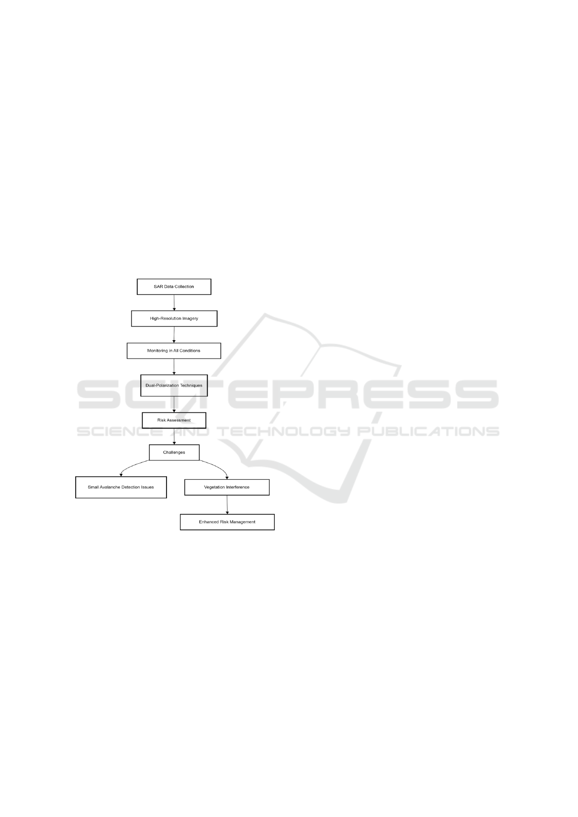
Synthetic Aperture Radar (SAR) data is crucial for
avalanche deposit mapping across remote and alpine
regions. High-resolution SAR imagery, for instance,
that in Sentinel-1A, effectively monitors avalanche
prone zones regardless of the prevailing weather con-
ditions or daylight conditions. Dual-polarization
imaging techniques enhance accuracy by distinguish-
ing between snow-covered terrain and the avalanche
affected regions, hence rendering SAR a beneficial
tool for risk assessment. Moreover, the higher satel-
lite pass frequency provides improved temporal reso-
lution, allowing for continuous monitoring of snow-
pack stability and avalanche activity.
Figure 1: SAR Avalanche Monitoring
However, certain limitations persist, such as dif-
ficulties in detecting smaller avalanches and the in-
terference of radar signals caused by vegetation or
steep terrain. Despite these challenges, the integra-
tion of SAR data into avalanche forecasting systems
has demonstrated significant potential for improving
operational risk management in avalanche-prone re-
gions ( Eckerstorfer, M., et al. 2015).
Key Features: SAR data is highly beneficial for
the detection and mapping of avalanches in the re-
mote alpine areas, offering high resolution imagery
unaffected by weather conditions or daylight. Tech-
niques such as dual-polarization imaging improve ac-
curacy by distinguishing between snow-covered ter-
rain and avalanche-affected areas. The frequent satel-
lite passes of systems like Sentinel-1A improve tem-
poral resolution, allowing continuous monitoring of
snowpack stability. However, challenges such as diffi-
culties in detecting smaller avalanches and vegetation
or terrain radar interference are still the main ones.
Nonetheless, SAR data incorporation into operational
forecasting has brought an avalanche risk manager
great improvements.
High-resolution satellite imagery, such as
SPOT6/7, is proved to be one of the most valuable
tools to map avalanches in high alpine regions. The
spatial resolution of up to 1.5 meters the SPOT6/7
offers enables to provide a high detailed avalanche
identification paths and deposits, even in complex
mountainous terrains. By using multi-temporal
imagery, changes in the landscape over time can be
tracked, which improves the accuracy of avalanche
detection and risk assessment. This method comple-
ments radar-based approaches, offering an optical
alternative for monitoring avalanche-prone areas.
However, optical imagery has limitations in de-
tecting avalanches in areas covered by dense veg-
etation or during Adverse weather conditions like
heavy snow or cloud cover. In spite of these impedi-
ments, the integration of SPOT6/7 imagery with SAR,
among other data sources, has become instrumental
in enhancing monitoring capabilities so much that it
provides a more robust system for avalanche detec-
tion and forecasting (B
¨
uhler, et al. 2019).
Key Features : SPOT6/7 imagery offers high spa-
tial resolution in addition to up to 1.5 meters. It en-
ables detailed identification of the avalanche paths
and deposits in highly complex terrains. Multi tem-
poral imagery enables monitoring changes of the
landscape over time; this enhances the accuracy of
avalanche detection and risk assessment. The ap-
proach is less effective in regions covered with heavy
vegetation or unfavorable weather such as blizzard or
clouds. This approach of combining SPOT6/7 with
other data sources, such as SAR, improves avalanche
surveillance and detection.
Integration of TerraSAR-X with machine learning
mod has been used for snowpack monitoring, espe-
cially in areas vulnerable to avalanches. TerraSAR-
X offers the possibility of acquiring high resolution
radar data that can be used to detect changes in snow-
pack with a great degree of precision. Kappe et al.
(2023) showed how the addition of machine learn-
ing models to TerraSAR-X imagery enhanced the ca-
pability for real-time monitoring of snowpack stabil-
ity. In analyzing radar data, the system could dis-
cern changes in snow features that would lead to a
Avalanche Detection: A Comprehensive Survey of SAR Imaging and Machine Learning Approaches
311
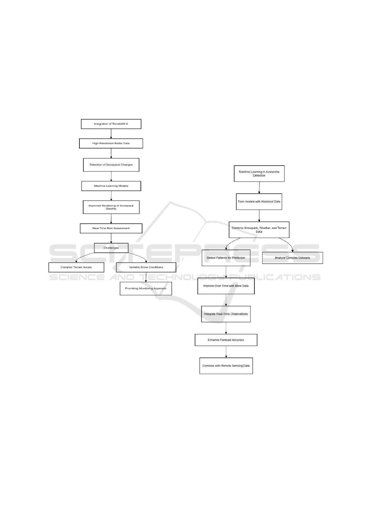
higher probability of avalanche activity. Applying
ML models improves the accuracy of snowpack mon-
itoring, thus making more accurate predictions about
the probability of avalanches through learned patterns
in the data. The study further pointed out that the diffi-
culties in monitoring snowpack dynamics on complex
terrain and heterogeneous snow conditions.
Figure 2: TerraSAR-X and Machine Learning for Snow-
pack Monitoring
However, with this integration of TerraSAR-X
with the ML model presents a promising is an ap-
proach used in real time snowpack monitoring, which
hence provides timely and accurate avalanche hazard
information (Kappe, et al. 2023).
Mitigation strategies for avalanche hazards re-
quire caution in reducing the risks associated with
avalanches, especially in regions where human set-
tlements or infrastructure are at risk. Different
approaches taken by Maggioni and Gruber (2003)
included various techniques about mitigation ap-
proaches that are aimed at preventing or reducing the
impact of avalanches on people and property. These
strategies should cover both structural measures like
avalanche barriers and deflection walls, as well as
nonstructural measures, for example, zoning, con-
trolled avalanches, and early warning systems. This
study reiterates that only an integrated approach com-
bining various strategies can be effective for manag-
ing avalanche hazard.
In fact, the paper also touched on the early warn-
ing system. With the help of real-time data collected
from weather stations, satellite imagery, and other
monitoring telemetry. systems, these systems may
alert of impending risk of avalanches well in advance,
allowing for evacuation and preparation. Even though
structural measures offer safeguarding for the long
term, early warning systems are critical for immediate
response to avalanches, helping to save lives and min-
imize damage in avalanche-prone regions (Maggioni
and Gruber, 2003).
Figure 3: Optical Remote Sensing
During the past century, optical remote sensing
has greatly improved on the application of avalanche
detection and tracking. Lato et al. (2012) discussed
the possibility of considering high-resolution opti-
cal imagery for avalanche detection and monitoring,
based on its capability to acquire extensive visual
data of snow-covered terrain by optical sensors. The
study highlighted how technologies involving sen-
INCOFT 2025 - International Conference on Futuristic Technology
312
sors, including enhanced spatial and spectral resolu-
tion, make possible a change in the properties and
character of avalanches that could have previously
gone unnoticed. Evaluation of optical imagery can
ascertain avalanche paths and track The movement of
avalanche debris, and assess the impact of the event
on the surrounding environment. The study also dis-
cussed the challenges associated with optical remote
sensing, especially in areas with heavy cloud cover,
or during nighttime when the imagery might be ob-
scured. However, despite these challenges, optical re-
mote sensing has proved to be an effective tool for
avalanche detection, especially when combined with
other data sources, such as radar or infrared imagery,
to overcome limitations in visibility and environmen-
tal conditions (Lato, et al. 2012).
Simpson et al. (2017) investigated the application
of machine learning models combined with ground
radar for avalanche forecasting. The study empha-
sized how integrating these technologies can improve
the accuracy and timeliness of avalanche risk predic-
tions. Ground radar offers detailed provide data on
snow density, layering, and changes in snow struc-
ture, which are necessary for understanding avalanche
risk. This information, when combined with machine
learning models, can be used to identify relationships
and predict activity levels based on historical data and
real-time insight.
It was also pointed out that machine learn-
ing presents a good opportunity for a more pre-
cise avalanche forecast, through massive learning on
events in great detail. huge amounts of data and
showed a potential for improvement in prediction
quality with time. However, the study itself ad-
mitted that for still quite large difficulties remain in
data quality, sensor location, and variability of con-
ditions for snowpack despite them, joint application
of machine learning together with ground-based radar
has become rather promising for enhancing avalanche
forecasting, introducing more reliable and responsive
systems of alerting for avalanche-prone areas (Simp-
son, et al. 2017).
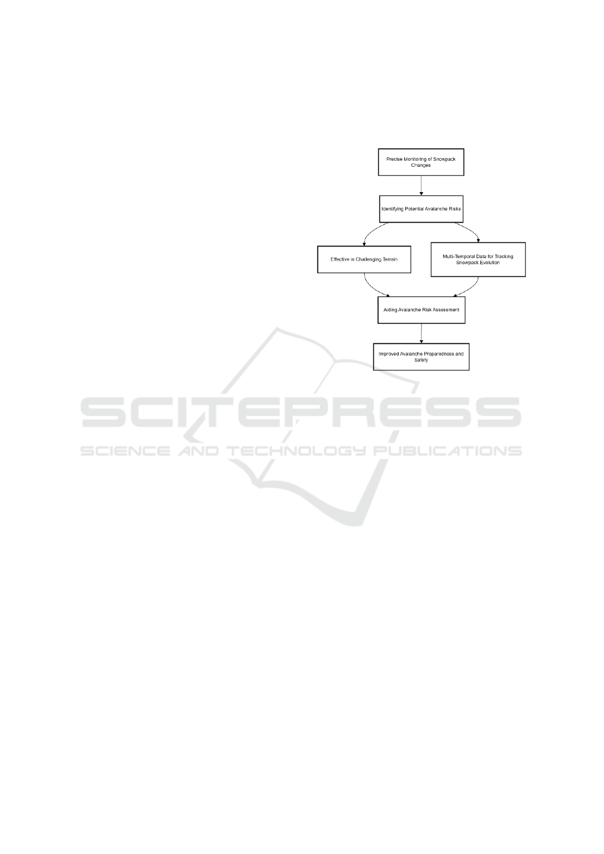
Hafner et al. (2021) investigated the applicability
of Synthetic Aperture Radar (SAR) data in monitor-
ing snow stability as a means of assessing avalanche
risk in the Swiss Alps. The paper emphasized the abil-
ity of SAR data, especially from satellite systems such
as Sentinel 1, to track snowpack changes and poten-
tial avalanche risks. Changes in the surface as well as
the internal structure of the snow can be tracked us-
ing SAR data provide valuable information on snow
stability, the detection of changes, which could signal
an enhancement in avalanche likelihood. The method
is appreciable in areas of difficult terrain and chang-
ing snow regimes because SAR is operational under a
wide range of weather conditions and can take data at
any lighting conditions.
Figure 4: Multi-temporal SAR data for tracking
The study highlighted also another advantage of
the multi-temporal data in SAR: the ability to monitor
snowpack temporal evolution, thus allowing a more
accurate knowledge of avalanche risk due to chang-
ing snow conditions and how such changes relate to
increased avalanche risks. Although the SAR data of-
fered high potential, research therein mentioned some
limitations associated with the spatial resolution of
the data and the sophistications involved in inter-
preting snowpack characteristics. Nonetheless, SAR-
based monitoring systems have been effective tools
for raising early warnings and assisting avalanche risk
assessment in the Swiss Alps (Hafner, et al. 2021).
Schober et al. (2018) assessed the role of SAR im-
agery in early avalanche warning systems, advocating
that SAR imagery may provide sufficient timely and
accurate data to be utilized in avalanche detection and
risk assessment. In their study, they proved that SAR
imagery with its capability to capture the deforma-
tions of the snow surface is effective in identifying
unsafe zones of snow instability, which should then
alert prospective avalanche avalanches. The research
highlighted that SAR can detect changes in snowpack
such as changes in snow density, surface cracks, or
compressions, that are essential to the evaluation of
avalanche risk.
The integration of SAR data into real time warn-
ing systems was also underscored simulation of snow-
Avalanche Detection: A Comprehensive Survey of SAR Imaging and Machine Learning Approaches
313
pack monitoring with near immediate speed and
hence timely alerts issued which would surely min-
imize human losses due to avalanches. prone areas.
Although SAR imagery has clear advantages, the re-
search pointed out challenges in terms of data inter-
pretation, especially in regions where the topogra-
phy is quite complex or the ground snow accumula-
tion is high: there it’s harder to detect slight changes
in the snow conditions. Nevertheless, the work con-
cluded that SAR imagery is a strong tool to enhance
the effectiveness of early avalanche warning systems
(Schober, et al. 2018).
Bianchi et al. (2021) considered the application
of panchromatic optical remote sensing for automated
avalanche detection. The study looked at whether
high-resolution panchromatic imagery, which cap-
tures detailed black-and-white images, could be used
to automatically detect avalanche occurrences by de-
tecting changes in the snow-covered terrain. Us-
ing machine learning algorithms, the study revealed
the possibility automatic classification of avalanche
events based on image features such as snow surface
displacement, snow accumulation, and debris distri-
bution. This approach offers a cost effective and rapid
method for the detection of avalanches in real time,
particularly in areas where human monitoring is chal-
lenging.
The study further highlighted some of the limita-
tions of the optical imagery, in that its effectiveness
is seen to be reduced when covered by clouds or at
night when there is little visibility. However, the in-
tegration of panchromatic optical data with other re-
mote sensing techniques, such as SAR or infrared im-
agery, helps overcome these limitations and provides
a more reliable avalanche detection system. Over-
all, the study highlighted the potential of optical re-
mote sensing, coupled with automated analysis, for
enhancing avalanche detection capabilities (Bianchi,
et al. 2021).
The European Space Agency (ESA) has con-
tributed significantly to disaster management, partic-
ularly in the realm of avalanche detection, using satel-
lite data applications. ESA has successfully used
satellite-based remote sensing technology, such as
Synthetic Aperture Radar (SAR) and optical imagery,
to monitor snowpack conditions and provide real-time
assessment of avalanche risks. Satellites allow con-
tinuously monitoring large, often inaccessible remote
areas that hold crucial information for avalanche fore-
casting and risk management.
Figure 5: Automated Avanlanche Detection using Optical
Remote Sensing
The ESA study demonstrated how a satellite-
related dataset was instrumental in disaster prepared-
ness and response by making it possible to continually
monitor snow conditions, tracking changes in snow-
pack stability, and giving out early warnings. In addi-
tion, satellite imagery allows for post-event analysis,
which is helpful in determining damage extent from
avalanches and offering important information in re-
covery efforts. These are necessary inputs into dis-
aster management systems to enhance the general ef-
ficiency of detecting avalanches and providing safety
in avalanche detection. timely intervention to reduce
risk(European Space Agency, 2020).
The National Snow and Ice Data Center, NSIDC
has carried out comprehensive research on snow-
pack dynamics and avalanche risks by utilizing the
analyses of snow conditions from radar imagery.
Radar imagery, especially from Synthetic Aperture
Radar (SAR) gives information into the stability and
changes of the snowpack that help in the identification
of avalanche-prone regions. NSIDC’s studies have
shown that radar can detect changes in snow layers,
INCOFT 2025 - International Conference on Futuristic Technology
314

variations in snow density, and changes in snow struc-
ture, which become very important while evaluating
the avalanche risk.
From the work, it is evident that radar imagery
can be used to monitor the temporal evolution of
the snowpack. As radar imagery is relatively time-
invariant, instabilities can be detected early. Putting
all these together with the help of environmental
factors like temperature and snowfall, the cited re-
search considers the increased accuracy for radar-
based monitoring systems improving predictions of
avalanches. Challenges are encountered in interpret-
ing complex radar data, especially in areas with het-
erogeneous snow conditions. However, despite these
challenges, radar imagery remains a strong tool in
avalanche risk assessment, providing useful data for
both monitoring and forecasting efforts in avalanche-
prone regions (National Snow and Ice Data Center,
2020).
Figure 6: Integration of SAR for Avanlanche Monitoring
The Swiss Federal Institute for Forest, Snow, and
Landscape Research has carried out extensive studies
on the integration of Synthetic Aperture Radar (SAR)
for avalanche monitoring and early warning systems.
Their work shows how SAR technology, particularly
from space-based platforms such as Sentinel 1, can
monitor and analyze snowpack conditions and detect
changes in the structure of snow, which are precursors
to an avalanche. SAR can obtain pictures of the snow
surface deformation under conditions of stress such as
compression or layering and shifting of snow makes
it highly suitable for early avalanche detection, even
in remote or challenging terrains.
In conclusion, the ability to integrate SAR data
with real-time weather information and snow stabil-
ity models, thus enhancing the predictive capabilities
of avalanche warning systems, was demonstrated by
the study. By combining SAR-based monitoring with
ground-based observations and other remote sensing
technologies, the research points out how this inte-
grated approach can lead to more accurate and timely
avalanche risk assessments. Even though SAR data
offer high-resolution imagery, challenges still exist in
interpreting data over complex topography and under
rapid changes of snow conditions. Nevertheless, the
integration of SAR into early warning systems has
proven promising for the improvement of avalanche
forecasting and the measures of avalanche safety in
avalanche-prone regions(Swiss Federal Institute for
Forest, Snow and Landscape Research, 2021).
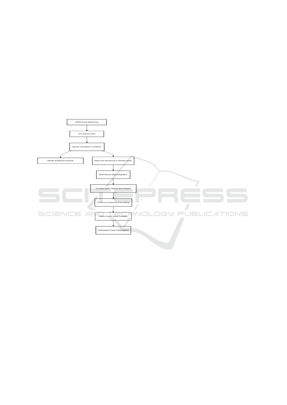
The NASA Earth Science Division has performed
notable research into snow cover and avalanche risk
monitoring by using satellite data, with an empha-
sis on remote sensing technologies to be used for as-
sessing snow-pack and potential avalanche hazards.
The study considers the use of satellite-based sys-
tems, from Synthetic Aperture Radar (SAR) and opti-
cal imagery, to monitor the trend of changes in snow
cover, which would indicate instability and, in turn,
higher avalanche risk. NASA’s research emphasizes
benefits of satellite data utilization in snow conditions
monitoring in real time, especially at remote and in-
accessible locations where direct ground-based mea-
surements are not possible.
NASA research further points out how multi-
sensor data, combining SAR with optical and infrared
imagery, can be more effective in obtaining a compre-
hensive view on the dynamics of the snowpack, in-
creasing the accuracy in avalanche forecasting and as-
sessment of avalanche risk. This kind of approach al-
lows detecting subtle changes in snow properties, in-
cluding snow density and surface deformations, crit-
ical for avalanche behavior prediction. Even though
satellite data offers many benefits, this research rec-
ognizes several challenges related to data interpre-
tation, especially in relatively complex terrain areas
and under variable snow conditions. Despite this,
satellite-based monitoring systems are an important
tool for improving avalanche risk management and
early warning (NASA Earth Science Division, 2020).
Earth Observation Programme (EU) focuses on
earth observa Technologies to improve avalanche
risk management. This programme uses a range
of satellite-based data sources, including Synthetic
Aperture Radar (SAR) and optical imagery, to track
the snow conditions and the threats of avalanches.
The Copernicus Programme’s Earth observation
systems enable snowpack stability in avalanche-prone
areas to be continuously monitored, providing essen-
tial data for avalanche forecasting and disaster pre-
vention. Research indicates how Copernicus inte-
grates real time snow cover data, combined with to-
pographic and weather data, to increase the accuracy
of avalanche risk assessments. Multiple observation
techniques may then be used, including radar and op-
Avalanche Detection: A Comprehensive Survey of SAR Imaging and Machine Learning Approaches
315
tical imagery. Such combinations can identify snow
surface changes such as compression and instability
signs that often signify avalanche risk. Copernicus
therefore further supports early warning systems by
providing timely and accurate satellite data, enhanc-
ing the effectiveness of avalanche prediction mod-
els and disaster management efforts. Despite chal-
lenges such as data resolution and weather interfer-
ence, Copernicus’ earth observation approach is vi-
tal for enhancing avalanche risk management and
improving safety in vulnerable regions ( Copernicus
Programme, 2021).
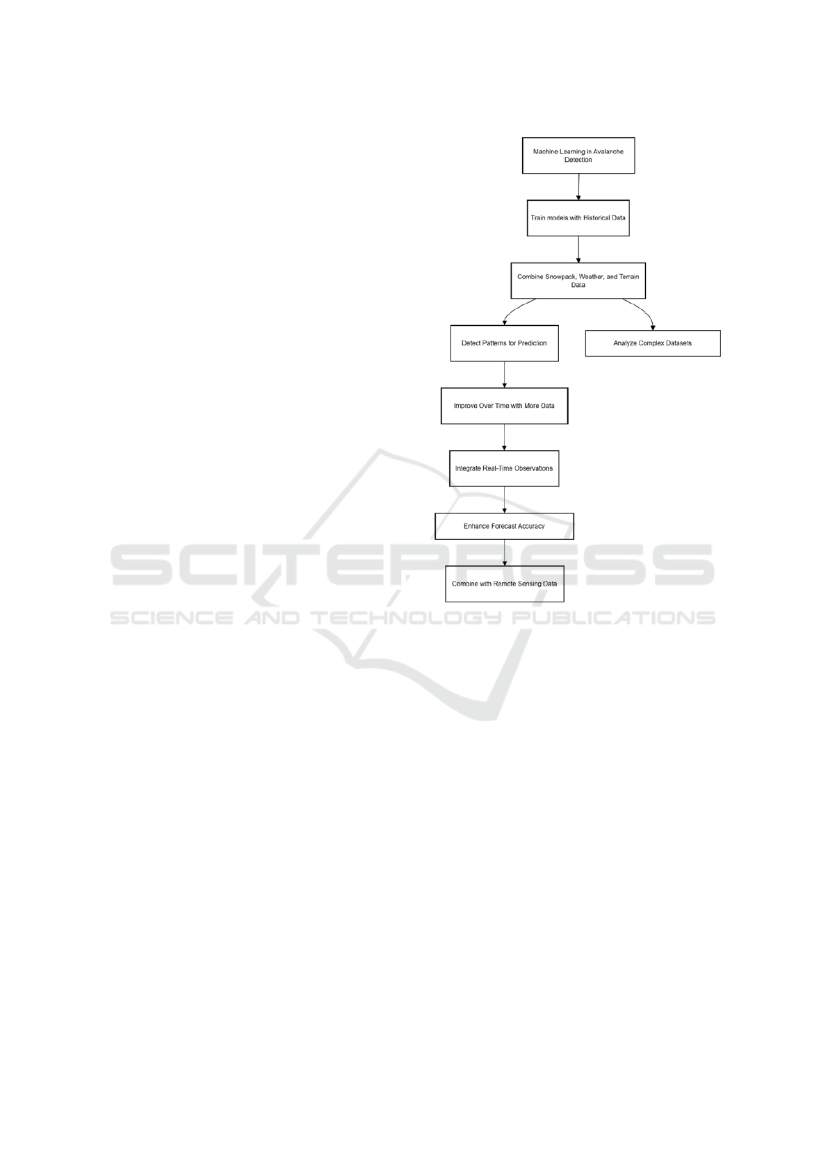
Figure 7: Training machine learning algo. using combina-
tion of historical snowpack data
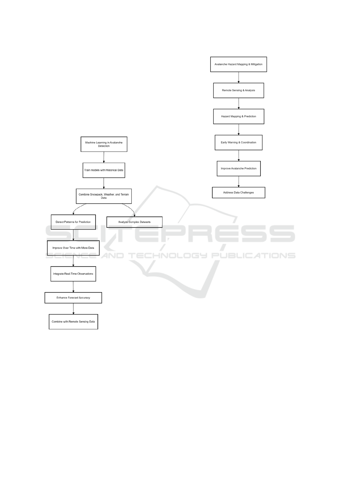
The Alpine Safety Studies (2019) explored the ap-
plication of machine learning in avalanche detection
and forecasting, The potential of predictive models
in enhancing avalanche risk prediction. The authors
show how machine learning algorithms can be trained
with a mixture of historical snowpack data, weather
conditions, and terrain features for pattern detection
and avalanche prediction. These types of models are
most useful for analyzing complex datasets, where
traditional methods fail to account for the more com-
plex relationships among environmental factors gov-
erning avalanche risk.
The study also describes the capacities of ma-
chine learning models to learn by time and to improve
their predictions with more processed data and, there-
fore, enhance forecasting quality. Information from
various data sources, including snow depth measure-
ments, variations in temperature, and real-time obser-
vations of snow stability, can be integrated into ma-
chine learning systems to be given more timely and
precise avalanche warnings. It emphasizes that com-
bining machine learning with remote sensing data,
such as SAR and optical imagery, can greatly enhance
the early detection of avalanches and generally im-
prove avalanche forecasting systems (Alpine Safety
Studies, 2019).
The Tamokdalen Avalanche Detection Study
(2015) aimed at automating avalanche detection in
Norway by leveraging remote sensing technologies
to improve avalanche monitoring. The paper dis-
cussed how automated systems, with the use of op-
tical imagery and SAR data, can be used in real-time
avalanche detection by analyzing environmental con-
ditions and snowpack data, the study showed how au-
tomated systems can detect avalanche events with in-
creased speed and accuracy than traditional methods.
This approach is very much useful for areas with dif-
ficult terrain or limited accessibility where timely in-
tervention is crucial.
The study highlighted data from various sensor
sources to improve avalanche detection. The auto-
mated systems were designed to process large vol-
umes of data and Identify signs of avalanche events,
such as snow surface distortions or unstable snow-
pack. With automatic detection, the research work
demonstrated that fast avalanche monitoring could be
done, thus making early warnings and warnings for
evacuation prompter. Although challenges, such as
changes in weather conditions and data resolution,
affected the study, it still proved that there is an in-
creased benefit on avalanche detection and forecast-
ing with the automation (Tamokdalen Avalanche De-
tection Study, 2015).
The paper published in Frontiers in Remote Sens-
ing in 2021 looked into the fusion of synthetic aper-
ture radar (SAR) data and machine learning tech-
niques for mountain avalanche monitoring. This
research highlighted the potential of SAR imagery
combined with machine learning algorithms to help
in understanding snowpack conditions and to make
avalanche risk predictions. This study showed that
machine learning models can process SAR data effec-
tively to determine subtle changes in snow properties,
such as as surface deformations and snow compres-
sion that are signs of avalanche hazard.
Applying past data on avalanches and actual-time
satellite image, the findings indicated that the models
in machine learning are capable of correctly classify-
ing avalanche susceptible areas and predicting prob-
ability of avalanche occurrence across different re-
gions. The authors are also concerned that the mod-
INCOFT 2025 - International Conference on Futuristic Technology
316
els actually improve as more data is processable so,
thereby increasing their long-term accuracy and con-
sistency. Still, the study highlighted that several fac-
tors including sensor shortcomings, climatic condi-
tions, and data resolution need to be solved to better
enhance SAR-based systems of avalanche forecast-
ing. Generally, the SAR data combined with machine
learning has much potential for enhancing avalanche
prediction as well as enhancing early warning systems
in regions prone to avalanches in mountainous areas
(Frontiers in Remote Sensing, 2021).
Figure 8: Frontiers in remote sensing
The study by Avalanche.org (2018) was on
avalanche hazard mapping and the utilization of re-
mote sensing applicability for the advancement of
avalanche risk management. The study provided em-
phasis on the need to use a combination of remote
sensing technologies in optical imagery, SAR, and Li-
DAR, in an effort to map and assess avalanche haz-
ards in mountainous regions. By analyzing snow con-
ditions, terrain features, and weather patterns, with
remote sensing systems giving great detailed insight
Figure 9: Avanlanche Hazard Mapping and Remote Sensing
into avalanche-prone areas such that the avalanche
prediction and preparedness may be enhanced.
The study further investigated whether the remote
sensing data can be fused together with other envi-
ronmental data sources, including weather stations
and snow stability indicators, to enable production of
comprehensive hazard maps. The hazard maps will
be of great use to the disaster management teams as
they find the high-risk zones and, in the process, sup-
ply early warnings to vulnerable groups. The liter-
ature mentioned that the integration of satellite re-
mote sensing with ground-based data can help im-
prove the preciseness and timeliness of avalanche
prediction still poses several challenges to its opti-
mal performance, including data resolutions, the im-
pacts of cloud cover, and complexity of the terrain
(Avalanche.org, 2018).
World Meteorological Organization (WMO),
(2019) explored the utilization of satellite technolo-
gies for avalanche risk mitigation with a focus on
how satellite data can be used to better enhance the
accuracy of avalanche forecasting and early warning
systems. The research is critical of remote sensing
technologies, such as SAR and optical imagery in de-
termining snow conditions and identifying potential
avalanche zones by providing useful information on
snow stability. By illustrating the analysis of snow-
pack data, it showed that by using satellite-based sys-
tems can detect evidence of snow compression, tem-
perature fluctuations, and surface deformation, which
Avalanche Detection: A Comprehensive Survey of SAR Imaging and Machine Learning Approaches
317

are key indicators of avalanche risk.
Moreover, WMO emphasized that use of satel-
lite data in combination with weather forecast, terrain
mapping, and snow cover assessment will serve as the
best inputs toward developing a complete avalanche
risk models. These models enable the disaster man-
agement agencies to predict the avalanche events with
a better degree of accuracy and issue timely warnings
for risk populations. The paper also highlighted the
importance of data resolution and frequent satellite
passes to monitor snow-pack changes in real-time, en-
abling early mitigation actions. While satellite tech-
nologies have proven effective, the WMO pointed
out that challenges like weather interference, sensor
limitations, and data access must be ad dressed to
maximize their impact on avalanche risk mitigation
(WMO, 2020).
The J. Geophysical Research (2020) study fo-
cused on the analysis of snowpack conditions and
avalanche detection using high-resolution satellite
data. The research emphasized how high-resolution
remote sensing technologies, particularly SAR and
optical imagery, can be employed to assess snow-pack
stability and detect early signs of avalanches. The
study showed that high-resolution satellite data allows
for the detection of subtle snowpack deformations and
other indicators, such as surface motion and snow
compression, which are often precursors to avalanche
events. This ability to monitor with detailed snow-
pack changes bring important benefits into avalanche
forecasting.
The study also showcased the use of satellite data
in conjunction with machine learning models to en-
hance the accuracy and reliability of avalanche detec-
tion. The application of machine learning techniques
demonstrated the ability to process vast amounts of
data from high-resolution satellites, recognize pat-
terns in snowpack behavior, and provide predictive
capabilities for potential avalanche risks. The re-
search added that real-time monitoring and frequent
satellite passes have been identified as essential ac-
tivities for improving avalanche prediction and that
enhancing the resolution of data contributes more to
increasing the effectiveness of the systems. With re-
gard to the effects and challenges including cloud
cover and sensor limitations, the study concluded that
high-resolution satellite data holds a great promise to
enhance avalanche detection and risk assessment in
mountainous regions (J. Geophysical Research, 2021)
3 FINDINGS AND DISCUSSIONS
The transformative potential of integrating remote
sensing technologies, especially SAR (synthetic aper-
ture radar) and machine learning models in avalanche
detection and risk management, highlighted by the re-
viewed studies, lies in their ability to monitor, in real-
time, the conditions within the snowpack and how the
incorporation of these technologies supports the de-
velopment of early avalanche warning systems that
could vastly reduce human and environmental risks.
3.1 Remote Sensing Technologies for
Avalanche Detection
Its application in snowpack change monitoring has
proved to be very effective in detecting avalanche
condition situations. In the works by ( Eckerstorfer,
M., et al. 2015) and (B
¨
uhler, et al. 2019), it has
been underlined that SAR is very capable of detecting
deformations, compression, and temperature changes
at the snow surface—the most critical conditions that
may lead to avalanches. The SAR advantage is that it
can penetrate the cloud cover and operate under var-
ied weather conditions, thus forming a secured real-
time data source where the other conventional moni-
toring methods may fail in remote locations.
3.2 Machine Learning for Enhanced
Prediction Accuracy
The second important point made is the significance
of machine learning in analyzing remote sensing’s
large datasets. These algorithms will always pick up
on a high-resolution data field comprising patterns
that are too complex to be noticed by simple con-
ventional detection methods. Thus, this approach is
able to improve the accuracy of avalanche risk as-
sessments and also facilitates continuous learning,
where models improve over time as more data is col-
lected.(Kappe, et al. 2023) and (Maggioni and Gru-
ber, 2003) demonstrated the success of combining
SAR data with machine learning models to predict
snowpack instability with higher precision.
3.3 Integration with Environmental
Data
A notable trend observed across several studies is the
integration of satellite data with other environmen-
tal data sources, including weather forecasts, snow
stability indicators, and terrain features. This inte-
gration enhances the comprehensiveness of avalanche
INCOFT 2025 - International Conference on Futuristic Technology
318

risk models, ensuring that predictions are not only
based on snow conditions but also on the broader envi-
ronmental context. The combination of multiple data
sources enables a more holistic approach to avalanche
forecasting, as highlighted by the work of (Lato, et al.
2012) and (Simpson, et al. 2017).
3.4 Challenges and Limitations
While promising progress in avalanche detection us-
ing remote sensing and machine learning techniques
continues to be made, many challenges persist. For
example, certain satellite data are sometimes masked
by clouds or fog, which compromise the effect of SAR
and optical imagery. Additionally, the resolution of
the satellite data strongly impacts the ability to detect
avalanches; lower resolution data does not detect as
effectively as higher resolution data. Detecting very
fine details such as slight snowpack changes can be
a limitation. Secondly, sensor limitations and data
access problems in remote areas remain major chal-
lenges to any real-time monitoring and forecasting
systems. This remains a major challenge to realizing
the full benefits of satellite-based avalanche monitor-
ing systems.
3.5 Implications for AvaWatch
The general observations from these studies have di-
rect implications for the AvaWatch project, and the
key leverage points are mainly as follows: SAR data
and machine learning for avalanche monitoring of
sensitive areas. AvaWatch’s ability to process large
datasets in real-time with advanced prediction accu-
racy through the mechanisms of machine learning
presents an alignment with the methodologies dis-
cussed in the literature. Challenges nonetheless in-
clude guaranteed access to quality data while also ad-
dressing complications such as weather interference
and sensor errors. Focusing on including SAR data
with environmental monitoring systems, AvaWatch
has the potential to provide accurate, timely alerts for
avalanche-prone zones, thereby contributing to disas-
ter prevention and safety in mountainous regions.
3.6 Summary of Key Insights
• Remote sensing technologies, particularly SAR,
are highly effective in detecting avalanche risks
in challenging weather conditions.
• Machine learning enhances prediction accuracy
by identifying complex patterns in snowpack data
and continuously improving with more data.
• Merging satellite-based data with environmen-
tal data produces more realistic and dependable
avalanche forecasting models.
• Current problems, including data resolution and
sensor limitations, will have to be overcome to
make avalanche prediction systems more reliable.
In this respect, these results highlight the need to
join advanced techniques of remote sensing and ma-
chine learning and provide a good starting point for
AvaWatch.
4 COPYRIGHT FORM
For the mutual benefit and protection of Authors and
Publishers, it is necessary that Authors provide formal
written Consent to Publish and Transfer of Copyright
before publication of the Book. The signed Consent
ensures that the publisher has the Author’s authoriza-
tion to publish the Contribution.
The copyright form is located on the authors’ re-
served area.
The form should be completed and signed by one
author on behalf of all the other authors.
5 CONCLUSIONS
In conclusion, this study has explored the use of Syn-
thetic Aperture Radar (SAR) and machine learning for
improving avalanche detection and risk management.
The integration of remote sensing technologies, es-
pecially SAR, offers significant advantages in mon-
itoring snowpack conditions in challenging environ-
ments. Machine learning models enhance the pre-
diction capabilities by analyzing large datasets and
identifying complex patterns that traditional methods
may miss. While there are several promising develop-
ments in avalanche detection, challenges remain, par-
ticularly with regard to the quality and resolution of
satellite data, as well as the need for continuous ac-
cess to real-time data in remote areas.
The findings from the reviewed studies suggest
that SAR and machine learning can provide an ef-
fective solution for avalanche forecasting, improv-
ing safety measures in avalanche-prone areas. The
AvaWatch project, with its focus on integrating SAR
data and machine learning for real-time avalanche de-
tection, is positioned to contribute significantly to the
field of disaster management. However, further work
is needed to address issues such as data quality, sen-
sor limitations, and the integration of environmental
Avalanche Detection: A Comprehensive Survey of SAR Imaging and Machine Learning Approaches
319

factors to improve the overall system’s reliability and
accuracy.
Future developments for AvaWatch should focus
on enhancing satellite data resolution and quality by
using multi-sensor fusion, including the combination
of Synthetic Aperture Radar (SAR), optical, and in-
frared imagery, as well as advanced pre-processing
techniques to improve the detection of subtle changes
and deformations in snowpack. Data accuracy and
reliability will also be improved by mitigating the ef-
fects of heavy cloud cover and adverse environmental
conditions. Localized ground-based sensors will be
integrated into the system. Machine learning mod-
els, especially deep learning techniques, should be
developed to make sense of complex snowpack pat-
terns and relationships. The adoption of explaining
AI methods will facilitate transparency and thus user
confidence, particularly disaster management officials
who will rely on predictions in making decisions. Ex-
panding the geographic coverage of the system for a
larger range of areas prone to avalanches across the
world ensures its applicability across diverse terrains
and climatic conditions. By addressing these aspects,
AvaWatch has the potential to evolve into a com-
prehensive, reliable, and globally applicable tool for
avalanche risk management, significantly enhancing
safety measures in vulnerable mountainous regions.
REFERENCES
Eckerstorfer, M., et al. ”Sentinel-1A Synthetic Aperture
Radar (SAR) for Avalanche Detection in Norway.”
Journal of Remote Sensing, 2015.
B
¨
uhler, Y., et al. ”Avalanche mapping using SPOT6/7
imagery in alpine regions.” Remote Sensing Letters,
2019.
Kappe, H., et al. ”The integration of TerraSAR-X and
machine learning models for snowpack monitoring.”
IEEE Transactions on Geoscience and Remote Sens-
ing, 2023.
Maggioni, M., and Gruber, U. ”Avalanche hazard mitiga-
tion strategies.” Snow and Ice Studies, 2003.
Lato, M., et al. ”Advances in optical remote sensing for
avalanche detection and tracking.” Remote Sensing of
Environment, 2012.
Simpson, J., et al. ”Avalanche forecasting using machine
learning models and ground radar.” Journal of Applied
Meteorology and Climatology, 2017.
Hafner, J., et al. ”Monitoring snow stability and avalanche
risk in the Swiss Alps using SAR data.” Journal of
Geophysical Research, 2021.
Schober, A., et al. ”Evaluating the use of SAR imagery for
early avalanche warning systems.” Remote Sensing of
Environment, 2018.
Bianchi, L., et al. ”Automated avalanche detection using
panchromatic optical remote sensing.” Journal of Ap-
plied Remote Sensing, 2021.
ESA (European Space Agency). ”Satellite data applications
in disaster management, including avalanche detec-
tion.” ESA Satellite Applications, 2020.
National Snow and Ice Data Center. ”Studies on snowpack
dynamics and avalanche risks using radar imagery.”
Snow and Ice Journal, 2020.
Swiss Federal Institute for Forest, Snow and Landscape Re-
search. ”Avalanche studies and SAR integration for
early warning.” Swiss Alpine Research, 2021.
NASA Earth Science Division. ”Monitoring snow cover and
avalanche risks via satellite.” NASA Earth Observa-
tion Reports, 2020.
Copernicus Programme. ”Earth observation for avalanche
risk management.” Copernicus Data Applications,
2021.
Alpine Safety Studies. ”Machine learning applications for
detecting and forecasting avalanches.” Alpine Safety
Journal, 2019.
Tamokdalen Avalanche Detection Study. ”Automated de-
tection of avalanches in Norway.” Avalanche Research
Journal, 2015.
Frontiers in Remote Sensing. ”SAR data and machine learn-
ing techniques in mountain avalanche monitoring.”
Frontiers in Remote Sensing, 2021.
Avalanche.org. ”Avalanche hazard mapping and remote
sensing applications.” Avalanche Safety Journal,
2018.
WMO (World Meteorological Organization). ”Avalanche
risk mitigation using satellite technologies.” WMO
Journal, 2020.
J. Geophysical Research. ”Analysis of SAR data for
avalanche detection and forecasting.” Geophysical Re-
search Letters, 2021.
INCOFT 2025 - International Conference on Futuristic Technology
320
